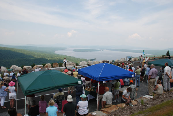
TOWNSHIP E – Maine Department of Transportation is proposing further improvements to the scenic byway at the Height of Land on Route 17, utilizing federal funding left over from the turnout project.
Currently, the 700-foot-long turnout provides parking for 40 vehicles on a long curve that is located on an overlook south of Rangeley and Oquossoc. More than 500 acres were purchased by the Rangeley Lakes Heritage Trust to preserve the view, which includes Mooselookmeguntic Lake. The Height of Land, first identified by Lady Bird Johnson in 1965 and one of the 150 roads in the U.S. originally designated as a Scenic Byway, is also adjacent to the Appalachian Trail.
A total of $2.9 million in federal funding was awarded to the project, which was a collaborative effort by the Maine DOT, Rangeley Lakes Heritage Trust and The Rangeley Lakes Scenic Byway. A small, three-vehicle pullout was expanded to include stone seats, interpretive panels and a landscaping design that incorporates Maine native plants.
The lowest bid on the byway project saved approximately $1.2 million of the federal funding, MDOT’s scenic byway coordinator Fred Michaud. Those funds can only be used on this site, which has led toward the development of a second phase: the creation of a 1,300-foot, paved walking path that would loop down from the byway. The path would provide space for displays with information about local, state and federal conservation efforts and would be handicap accessible. Stairs would provide a shortcut from the end of the pathway, back to the byway.
Additionally, the project would call for the creation of a slightly higher spot near the center of the byway. Currently, MDOT landscape architect Larry Johannesman said, the highest edge is further west, resulting in visitors congregating near the byway entrance.
MDOT is seeking partners to own and/or maintain the byway, consisting in the short term of mostly sweeping. There are no toilets or trash cans on site that would require maintenance. Michaud met with the county commissioners about the possibility of Franklin County acquiring the land, which is currently deeded to the Rangeley Lakes Heritage Trust.
Other potential partners include the RLHT, the local area Chamber and the town of Rangeley itself. While the federal funding could only be used for capital improvements, other MDOT programs such as the Municipal Partnership Initiative could provide some cost sharing for eventual, larger-scale maintenance, such as paving.
Commissioner Charlie Webster of Farmington said that his only concern was paying for paving in 15 or 20 years. Commissioner Gary McGrane suggested that a trust or other organization might own the property, with the county working as a partner. Franklin County maintains a tax increment financing district associated with the TransCanada wind power project on Kibby Mountain, and those funds could be used to support scenic byways and walking paths.

In other, TIF-related business, Greater Franklin Development Corporation Director Alison Hagerstrom provided commissioners with the TIF Committee’s recommendations to fund two projects. The first was a reimbursement of $10,000 to help cover the cost of replacing a collapsed bridge over Cherry Run by the Arnold Trails Snowmobile Network. The second was to provide $16,000 to the Maine Appalachian Trail Club to go toward $41,600 in trail improvements in Township D.
Commissioners voted unanimous to approve the committee’s recommendations.


Does anyone know if they fixed the road up over yet? It was so horrific a month or so ago when we went up on motorcycles that we swore we’d never go again.
Many parts of that mountain highway were built “by hand” in the 1930’s by the Civilian Conservation Corps. and yes it can be pretty rough because despite paving its an old shallow roadbed. But the destination is well worth going a tad slower and enjoying the view.
The talked about renovations would be a draw and a boon to the local economy and something all of Franklin County could be proud to be a part of and benefit from. No where else in the US is there a significant monument to conservation as a whole and so many who inspired and participated in America’s modern conservation movement have Maine ties and could be celebrated. It will be a beautiful attraction set in a great spot…rough road or not. When it is built the other payback would include a larger traffic count, which does get roads fixed in our State.